
Second place biography · Arabic first
Lifta
A village on Jerusalem’s western slope where the spring, terraces, and stone houses open into documented life before 1948 and a careful reading of what remains—without turning ruins into a substitute for people.
لِفْتا · Lifta
Non-evidentiary contemporary illustration
Three documented population snapshots
1922
1,451Source · claim-000022
The Palestine Open Maps Lifta record reports a population of 1,451 in 1922.
- Source
- palopenmaps-lifta
- Method caveat
- Locality API response; properties.pop_1922
- Review status
- Research draft
1931
1,893 · 410 housesSource · claim-000023
The PalQuest table reports 1,893 people in Lifta in 1931 and 410 houses.
- Source
- ips-palquest-lifta
- Method caveat
- Key Figures; 1931 population row and Number of Houses
- Review status
- Research draft
1944/45
2,550Source · claim-000024
PalQuest reports 2,550 people in 1944/45 and states that the estimate included 20 Christians while the population was predominantly Muslim.
- Source
- ips-palquest-lifta
- Method caveat
- Key Figures; population table, and Village Before 1948; population paragraph
- Review status
- Research draft
Life before 1948
Lifta’s biography does not begin with displacement. This section brings together documented settlement form, water and agriculture, education, institutions, and daily ties to Jerusalem.
The profile describes late-nineteenth-century Lifta on a steep hillside, with a spring and rock-cut tombs to the south, and later describes stone houses and curving streets following the contours.
Source · claim-000021
- Source
- ips-palquest-lifta
- Method caveat
- Village Before 1948; late-nineteenth-century and settlement-form paragraphs
- Review status
- Research draft
The Palestine Open Maps Lifta record reports a population of 1,451 in 1922.
Source · claim-000022
- Source
- palopenmaps-lifta
- Method caveat
- Locality API response; properties.pop_1922
- Review status
- Research draft
The PalQuest table reports 1,893 people in Lifta in 1931 and 410 houses.
Source · claim-000023
- Source
- ips-palquest-lifta
- Method caveat
- Key Figures; 1931 population row and Number of Houses
- Review status
- Research draft
PalQuest reports 2,550 people in 1944/45 and states that the estimate included 20 Christians while the population was predominantly Muslim.
Source · claim-000024
- Source
- ips-palquest-lifta
- Method caveat
- Key Figures; population table, and Village Before 1948; population paragraph
- Review status
- Research draft
The profile reports a mosque, the shrine of Shaykh Badr, shops, a boys’ elementary school, a girls’ school founded in 1945, two coffeehouses, and a social club, and describes strong economic ties with Jerusalem.
Source · claim-000025
- Source
- ips-palquest-lifta
- Method caveat
- Village Before 1948; institutions and economy paragraphs
- Review status
- Research draft
The profile reports that drinking water came from a spring in Wadi al-Shami and that land was planted with cereals, vegetables, fruit, olives, and grapes; olives covered 1,044 dunums and 3,248 dunums were planted in cereals in 1944/45.
Source · claim-000026
- Source
- ips-palquest-lifta
- Method caveat
- Village Before 1948; water and agriculture paragraph
- Review status
- Research draft
The 1944/45 ownership table reports 8,743 dunums: 7,780 classified as Arab, 756 as Jewish, and 207 as public, using the source’s historical categories.
Source · claim-000027
- Source
- ips-palquest-lifta
- Method caveat
- Key Figures; Land Ownership 1944/45 table
- Review status
- Research draft
Location and valley
Present context, not historical evidence
Lifta in the present-day landscape
An approximate Lifta locality point from the Palestine Open Maps record. It is not a historical boundary, building plan, or proof of the position of every part of the village.
- Coordinates
- 31.79743, 35.19620
- Precision
- Approximate locality point
- Map state date
- Present-day map context accessed 25 July 2026. Individual map features have varying update dates.
- Claim ID
- claim-000030
A wide chronology
The timeline works as narrative breathing space: long historical layers, a living village, the rupture of 1947–1948, and what remained. Debated identifications never merge with documented facts.
- to the 19th c.Layers of placeHistorical identifications, agriculture, and slope
- 1922–1945A village tied to JerusalemPopulation, institutions, water, and markets
- 1947–presentDisplacement and remainsViolence, demolition, remains, and heritage records
- Ancient and medieval layersDisputed
A debated historical identification
The source links Lifta with Mey Neftoach in qualified terms and records later place names. This layer remains marked “disputed” rather than being converted into certainty.
Source · claim-000018
- Source
- ips-palquest-lifta
- Method caveat
- Village Before 1948; historical-identification paragraph
- Review status
- Research draft
- 1596Documented
An agricultural village in an Ottoman register
The source reports 396 people and taxes tied to cereals, olives, fruit, orchards, and vineyards.
Source · claim-000019
- Source
- ips-palquest-lifta
- Method caveat
- Village Before 1948; 1596 register paragraph
- Review status
- Research draft
- 1834Documented
A battle at Jerusalem’s approaches
The source places Lifta at the centre of a confrontation between Ibrahim Pasha’s army and local rebels led by Shaykh Qasim al-Ahmad.
Source · claim-000020
- Source
- ips-palquest-lifta
- Method caveat
- Village Before 1948; 1834 paragraph
- Review status
- Research draft
- Late 19th centuryDocumented
Slope, spring, and contour-following form
Lifta appears on a steep slope; stone houses and curving streets follow the terrain, with the spring central to the landscape.
Source · claim-000021
- Source
- ips-palquest-lifta
- Method caveat
- Village Before 1948; late-nineteenth-century and settlement-form paragraphs
- Review status
- Research draft
- 1922 → 1931Documented
Two pre-Nakba population snapshots
Palestine Open Maps reports 1,451 people in 1922; PalQuest reports 1,893 people and 410 houses in 1931.
Source · claim-000022
- Source
- palopenmaps-lifta
- Method caveat
- Locality API response; properties.pop_1922
- Review status
- Research draft
Source · claim-000023
- Source
- ips-palquest-lifta
- Method caveat
- Key Figures; 1931 population row and Number of Houses
- Review status
- Research draft
- 1944/45Documented
2,550 people and institutions tied to Jerusalem
The last documented population snapshot in this record sits alongside schools, shops, two coffeehouses, a social club, and daily economic ties to Jerusalem.
Source · claim-000024
- Source
- ips-palquest-lifta
- Method caveat
- Key Figures; population table, and Village Before 1948; population paragraph
- Review status
- Research draft
Source · claim-000025
- Source
- ips-palquest-lifta
- Method caveat
- Village Before 1948; institutions and economy paragraphs
- Review status
- Research draft
Source · claim-000026
- Source
- ips-palquest-lifta
- Method caveat
- Village Before 1948; water and agriculture paragraph
- Review status
- Research draft
Source · claim-000027
- Source
- ips-palquest-lifta
- Method caveat
- Key Figures; Land Ownership 1944/45 table
- Review status
- Research draft
- 1945Documented
A girls’ school is founded
The source dates the founding of the girls’ school to 1945, within Lifta’s pre-displacement institutional life.
Source · claim-000025
- Source
- ips-palquest-lifta
- Method caveat
- Village Before 1948; institutions and economy paragraphs
- Review status
- Research draft
- December 1947 – early 1948Documented
Violence, raids, demolition, and displacement
The page does not compress displacement into one day: the source brings together the 28 December coffeehouse attack, subsequent raids and demolitions, and successive departures.
Source · claim-000028
- Source
- ips-palquest-lifta
- Method caveat
- Occupation and Depopulation; December 1947 through February 1948 paragraphs
- Review status
- Research draft
- Present / 2015Documented
Visible remains and a perspective-bound heritage record
PalQuest records visible remains, while the UNESCO tentative-list file describes dwellings, the spring, and terraces. Its wording is attributed to the submitting State Party, not treated as independent endorsement.
Source · claim-000029
- Source
- ips-palquest-lifta
- Method caveat
- The Village Today; paragraphs 100–101
- Review status
- Research draft
Source · claim-000031
- Source
- unesco-lifta-6061
- Method caveat
- Record header, disclaimer, and Description; lines 56–85
- Review status
- Research draft
3 project rights-reviewed items
The village visual record
An archival aerial frame with a qualified title, a 1940s map, and a present-day photograph of the remains. Each item has a different evidence role and visible limit.
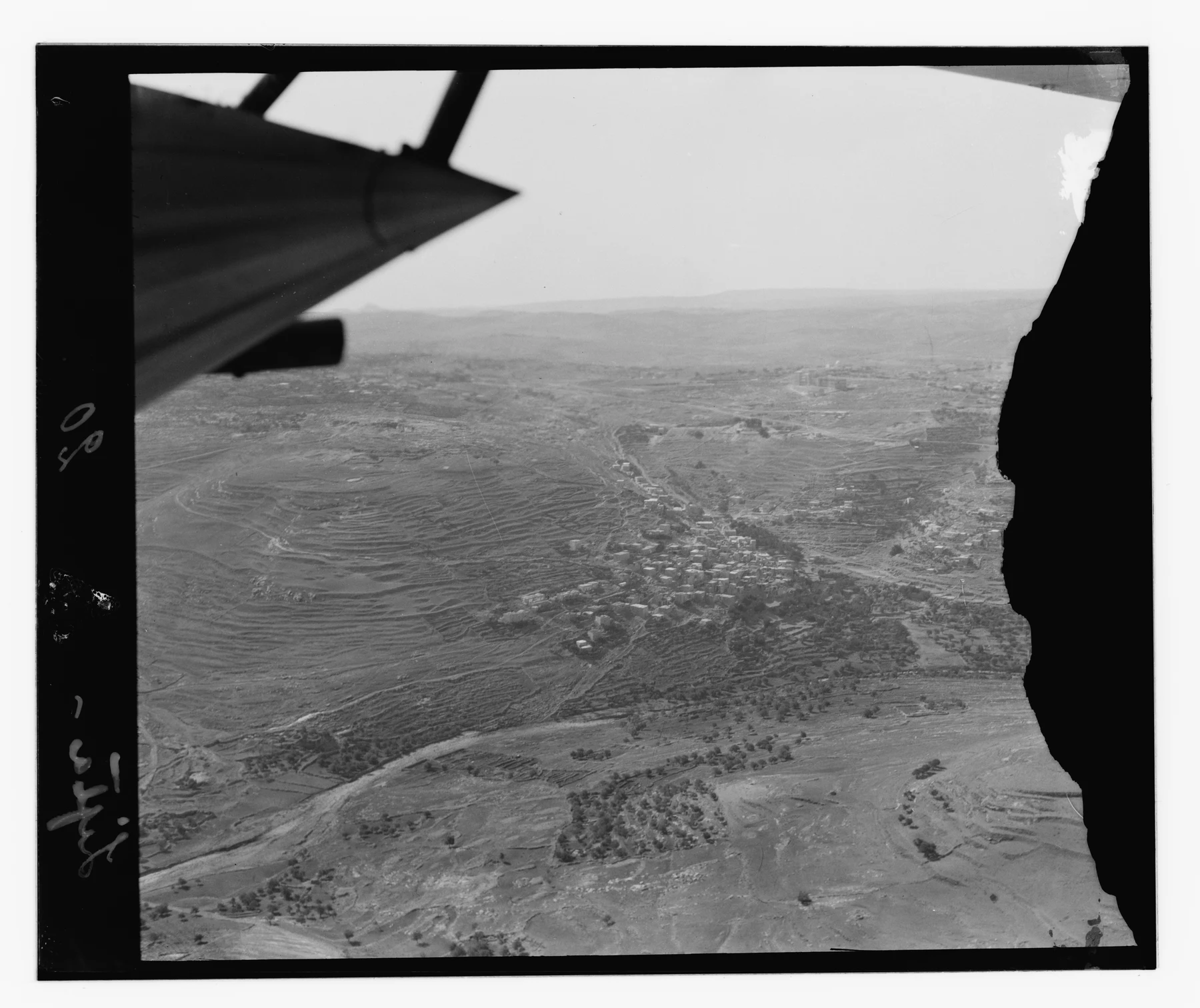
Aerial frame catalogued “Lifta[?]”
The aerial frame shows a village mass and terraces. The question mark is part of the Library of Congress title and must remain; the image is not used to prove a specific building.
Archival visual evidence with a not-fully-settled place identification.
Item advisory: No known restrictions on publication; not a copyright warranty.
Open the Library of Congress record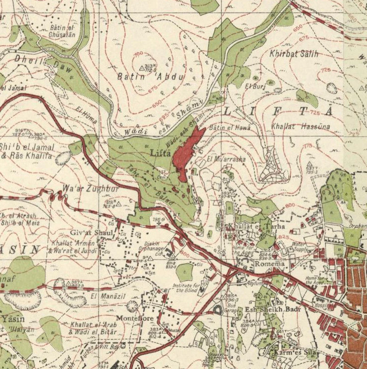
1940s Survey of Palestine map
A historical map extract of Lifta’s area in a comparison series prepared with Palestine Open Maps. It does not represent current title or ownership boundaries.
Historical topographic context; not a precise building plan.
Survey map is public domain; OpenStreetMap data is ODbL where applicable.
Open the map and rights record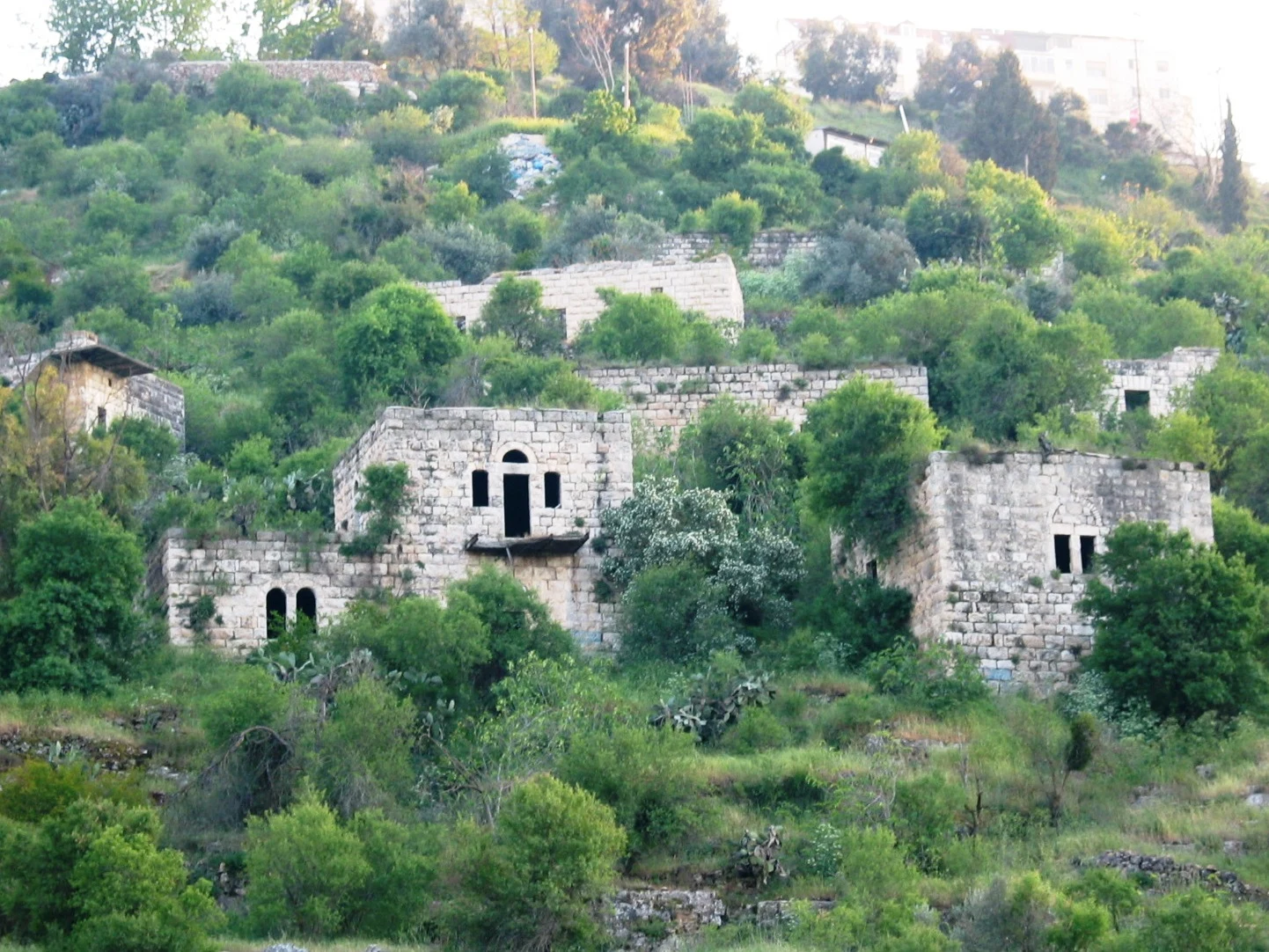
Surviving houses in 2004
A present-day photograph of Lifta’s surviving houses. It supports reading material and current condition only, not a house’s form or use before 1948.
Present-day context only; not a pre-Nakba photograph.
Attribution licence; credit Ester Inbar and link the source.
Open the image and attribution termsDo you hold visual material connected to Lifta?
The submission channel is not open yet. Review the ownership, consent, and privacy requirements that must precede any transfer.
Visual lab · evidence separated from condition
If the village had continued
Three visual routes that do not forecast: aerial pairs an archival frame with a conditional 2026 scene; street and wide views compare generated interpretation with conditional continuity.
Generated images are interpretation or scenario—not evidence
Only the aerial route begins with an archival frame; both sides of the street and wide routes are generated and persistently labelled.
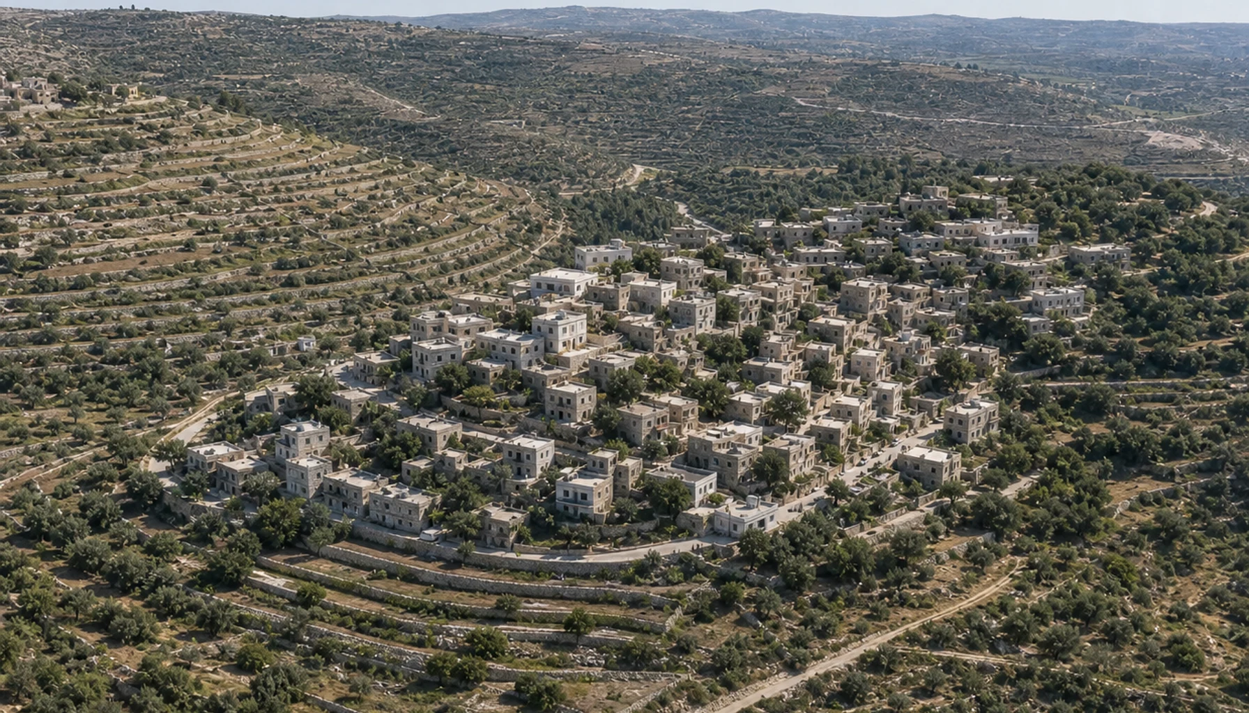 Generated image · conditional 2026 scenario2026
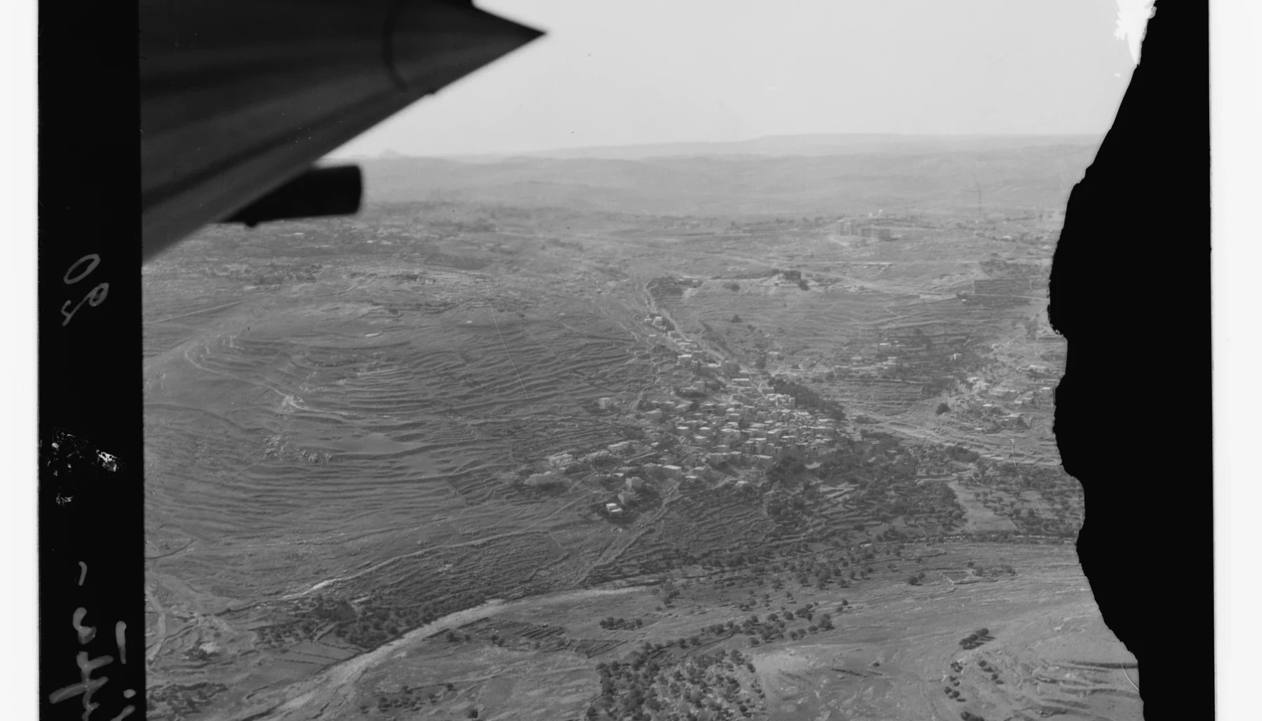 Archival frame · catalogued “Lifta[?]”Between 1910 and 1946
This pairs a real archival frame with a generated scenario. It is not a repeat aerial photograph from the same aircraft or moment.
Drag the handle directly on the image to either edge. Arrow keys, Home, and End also work.
Trust and source panel
Known, disputed, and conditional material remain separate layers that readers can inspect at source.
Registered to a source
- Population snapshots for 1922, 1931, and 1944/45 with each period retained.
- 410 houses in 1931 and a description of stone, contour-following settlement form.
- Village institutions, agriculture, the spring, and economic ties to Jerusalem.
- One approximate present-day point and external links centred on the same coordinate.
Unresolved or unavailable
- A precise historical boundary and the location of every pre-1948 house and street.
- The identity and exact condition of every building visible in the aerial frame.
- Named independent factual and language review of every claim.
- Any alternative development path as a prediction or fact.
Lifta — Interactive Encyclopedia of the Palestine Question
Historical narrative, tables, displacement, and site condition
Institute for Palestine StudiesOpen the original source ↗Lifta locality record
Approximate point and 1922/1945 snapshots
Palestine Open MapsOpen the original source ↗Tentative-list file 6061
Preservation description attributed to the submitting State Party
UNESCO World Heritage CentreOpen the original source ↗Aerial frame catalogued “Lifta[?]”
Archival visual evidence with a not-fully-settled place identification.
Library of CongressOpen the original source ↗1940s Survey of Palestine map
Historical topographic context; not a precise building plan.
Wikimedia CommonsOpen the original source ↗Surviving houses in 2004
Present-day context only; not a pre-Nakba photograph.
Wikimedia CommonsOpen the original source ↗Record limits
The page contains no precise historical boundary, building plans, or published oral testimony. The library catalogue keeps a question mark in the aerial image title, and every generated image remains outside the evidence layer.
Review sources