Third place biography · Arabic first
al-Birwa
A village on a rocky hill at the Acre plain, organised by two intersecting roads and sustained by schools, a mosque, a church, cereal and olive land, and three presses—a biography that begins with documented life rather than reducing the place to displacement.
البِرْوَة · al-Birwa
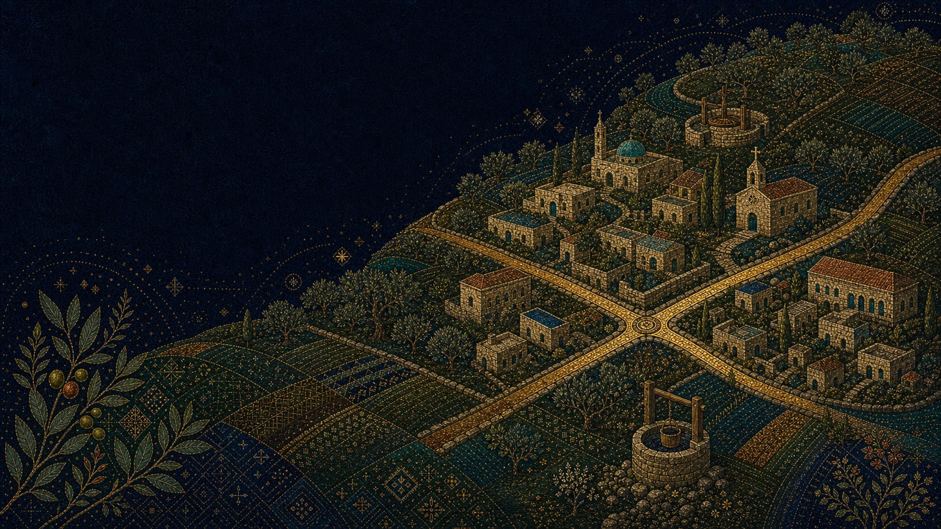
Non-evidentiary contemporary illustration
Three documented population snapshots
1596
121 · Ottoman registerSource · claim-000033
The profile records al-Birwa in 1596 in the nahiya of Acre within the liwa of Safad, with 121 people and taxes tied to cereals, fruit, goats, and beehives.
- Source
- ips-palquest-birwa
- Method caveat
- Village Before 1948; 1596 register paragraph
- Review status
- Research draft
1931
996 · 224 housesSource · claim-000035
The PalQuest tables report 996 people and 224 houses in al-Birwa in 1931.
- Source
- ips-palquest-birwa
- Method caveat
- Key Figures; 1931 population row and Number of Houses
- Review status
- Research draft
1944/45
1,460Source · claim-000036
The profile reports 1,460 people in 1944/45, including 1,330 Muslims and 130 Christians.
- Source
- ips-palquest-birwa
- Method caveat
- Key Figures; population table, and Village Before 1948; population paragraph
- Review status
- Research draft
Life before 1948
This section brings together documented settlement form, institutions, education, agriculture, religious plurality, and everyday economy while keeping every number attached to its period and definition.
The profile describes a village on a rocky hill sloping toward the Acre plain, built around two intersecting roads, with stone-and-mud houses under wood-and-mud roofs and later Mandate-era cement roofs.
Source · claim-000034
- Source
- ips-palquest-birwa
- Method caveat
- Village Before 1948; location and settlement-form paragraphs
- Review status
- Research draft
The PalQuest tables report 996 people and 224 houses in al-Birwa in 1931.
Source · claim-000035
- Source
- ips-palquest-birwa
- Method caveat
- Key Figures; 1931 population row and Number of Houses
- Review status
- Research draft
The profile reports 1,460 people in 1944/45, including 1,330 Muslims and 130 Christians.
Source · claim-000036
- Source
- ips-palquest-birwa
- Method caveat
- Key Figures; population table, and Village Before 1948; population paragraph
- Review status
- Research draft
The profile reports a mosque, a church, and two schools: the boys’ school was built in 1882 and the girls’ school was founded in 1942/43.
Source · claim-000037
- Source
- ips-palquest-birwa
- Method caveat
- Village Before 1948; institutions and education paragraph
- Review status
- Research draft
For 1944/45 the profile records 8,457 dunums in cereals and 1,548 dunums in irrigated land or orchards, including 1,500 dunums of olives, and reports three olive presses.
Source · claim-000038
- Source
- ips-palquest-birwa
- Method caveat
- Key Figures; Land Use table, and Village Before 1948; agriculture paragraph
- Review status
- Research draft
The 1944/45 land-ownership table records 13,542 dunums in total: 12,939 classified as Arab, 546 as Jewish, and 57 as public under the source’s historical categories.
Source · claim-000039
- Source
- ips-palquest-birwa
- Method caveat
- Key Figures; Land Ownership 1944/45 table
- Review status
- Research draft
The PalQuest biography of Mahmoud Darwish records his birth in al-Birwa on 13 March 1941.
Source · claim-000040
- Source
- ips-palquest-mahmoud-darwish
- Method caveat
- Biography header; Birth
- Review status
- Research draft
Hill and Acre plain
Present context, not historical evidence
al-Birwa in the present-day landscape
An approximate locality point for al-Birwa. It is not a historical boundary, building plan, or proof of the position of every part of the village.
- Coordinates
- 32.905278, 35.180278
- Precision
- Approximate locality point
- Map state date
- Present-day map context accessed 25 July 2026. Individual map features have varying update dates.
- Claim ID
- claim-000043
A wide chronology
The chronology runs from the eleventh century and an Ottoman register through schools and demographic-economic life, then carefully separates the stages of June–July 1948 and what remained.
- 1047–19th c.Layers of placeName, register, and agriculture at the Acre plain
- 1882–1945A living villageSchools, institutions, population, olives, and cereals
- 1948–presentRupture and remainsDisplacement stages, settlements, and surviving fabric
- 1047 and afterDocumented
The village name on a historical route
Nasir Khusraw passes through and names Birwa; the profile records a later Crusader name, placing the village within layers of movement and settlement older than the twentieth century.
Source · claim-000032
- Source
- ips-palquest-birwa
- Method caveat
- Village Before 1948; medieval-history paragraph
- Review status
- Research draft
- 1596Documented
An agricultural village in an Ottoman register
The register connects the population with cereals, fruit, goats, and beehives; it is an administrative snapshot, not a modern census.
Source · claim-000033
- Source
- ips-palquest-birwa
- Method caveat
- Village Before 1948; 1596 register paragraph
- Review status
- Research draft
- Late 19th centuryDocumented
Rocky hill, plain, and olives
Al-Birwa appears at the edge of the Acre plain, with a well to the south and olives to the north, while its settlement grows around two intersecting roads.
Source · claim-000034
- Source
- ips-palquest-birwa
- Method caveat
- Village Before 1948; location and settlement-form paragraphs
- Review status
- Research draft
- 1882 → 1942/43Documented
Two schools and institutional life
The boys’ school predates the Mandate, and the girls’ school joins it in 1942/43 within a village that also includes a mosque and a church.
Source · claim-000037
- Source
- ips-palquest-birwa
- Method caveat
- Village Before 1948; institutions and education paragraph
- Review status
- Research draft
- 1931Documented
996 people and 224 houses
The tables provide a documented demographic and built-form snapshot without equating houses with households or surviving structures.
Source · claim-000035
- Source
- ips-palquest-birwa
- Method caveat
- Key Figures; 1931 population row and Number of Houses
- Review status
- Research draft
- 13 March 1941Documented
Mahmoud Darwish is born in al-Birwa
The biography records the poet’s birth in the village; this page does not reproduce his writing or images without separate rights review.
Source · claim-000040
- Source
- ips-palquest-mahmoud-darwish
- Method caveat
- Biography header; Birth
- Review status
- Research draft
- 1944/45Documented
1,460 people and an olive-and-cereal economy
The last documented population snapshot here sits alongside cereal and olive land, three presses, and Muslim and Christian communities.
Source · claim-000036
- Source
- ips-palquest-birwa
- Method caveat
- Key Figures; population table, and Village Before 1948; population paragraph
- Review status
- Research draft
Source · claim-000038
- Source
- ips-palquest-birwa
- Method caveat
- Key Figures; Land Use table, and Village Before 1948; agriculture paragraph
- Review status
- Research draft
Source · claim-000039
- Source
- ips-palquest-birwa
- Method caveat
- Key Figures; Land Ownership 1944/45 table
- Review status
- Research draft
- June–July 1948Documented
Capture, recapture, harvest, then firm control
The rupture is not compressed into one day. Accounts differ on some fighting details, while the source makes clear the multiple stages of capture, temporary return and harvest, and firm control in mid-July.
Source · claim-000041
- Source
- ips-palquest-birwa
- Method caveat
- Occupation and Depopulation; 11 June through mid-July 1948 paragraphs
- Review status
- Research draft
- 1949 → presentDocumented
Settlements and surviving village fabric
The record notes the establishment of Yas’ur and Achihud and the survival of houses, shrines, a school, debris, and graves; surviving fabric is limited material evidence, not a substitute for the community biography.
Source · claim-000042
- Source
- ips-palquest-birwa
- Method caveat
- Israeli Settlements on Village Lands; and The Village Today
- Review status
- Research draft
3 project rights-reviewed items
The available visual record
No pre-1948 photograph with complete display readiness has yet been located. The archive therefore presents one historical map and two present-day photographs with explicit limits; a 1928 image remains unpublished pending rights readiness.
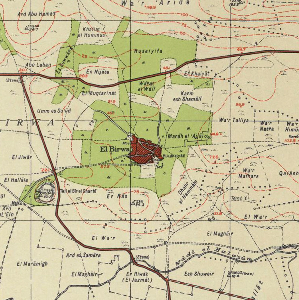
1940s Survey of Palestine map
A topographic extract of al-Birwa’s area from a comparison series prepared with Palestine Open Maps. It is neither a current ownership map nor a precise building plan.
Historical topographic and road context; it does not prove facades or building heights.
Survey map is public domain; OpenStreetMap data is ODbL where applicable.
Open the map and rights record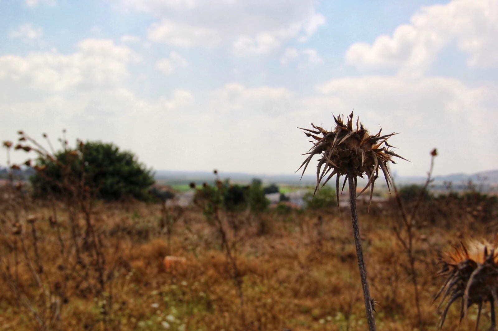
Overlook toward al-Birwa’s site
A present-day photograph of the village site. It supports reading terrain, vegetation, and current condition only—not the village’s pre-1948 form.
Present-day landscape context only; not a pre-Nakba photograph.
CC BY-SA 4.0; credit Ola Watad, link the licence, and note the technical conversion.
Open the image and licence terms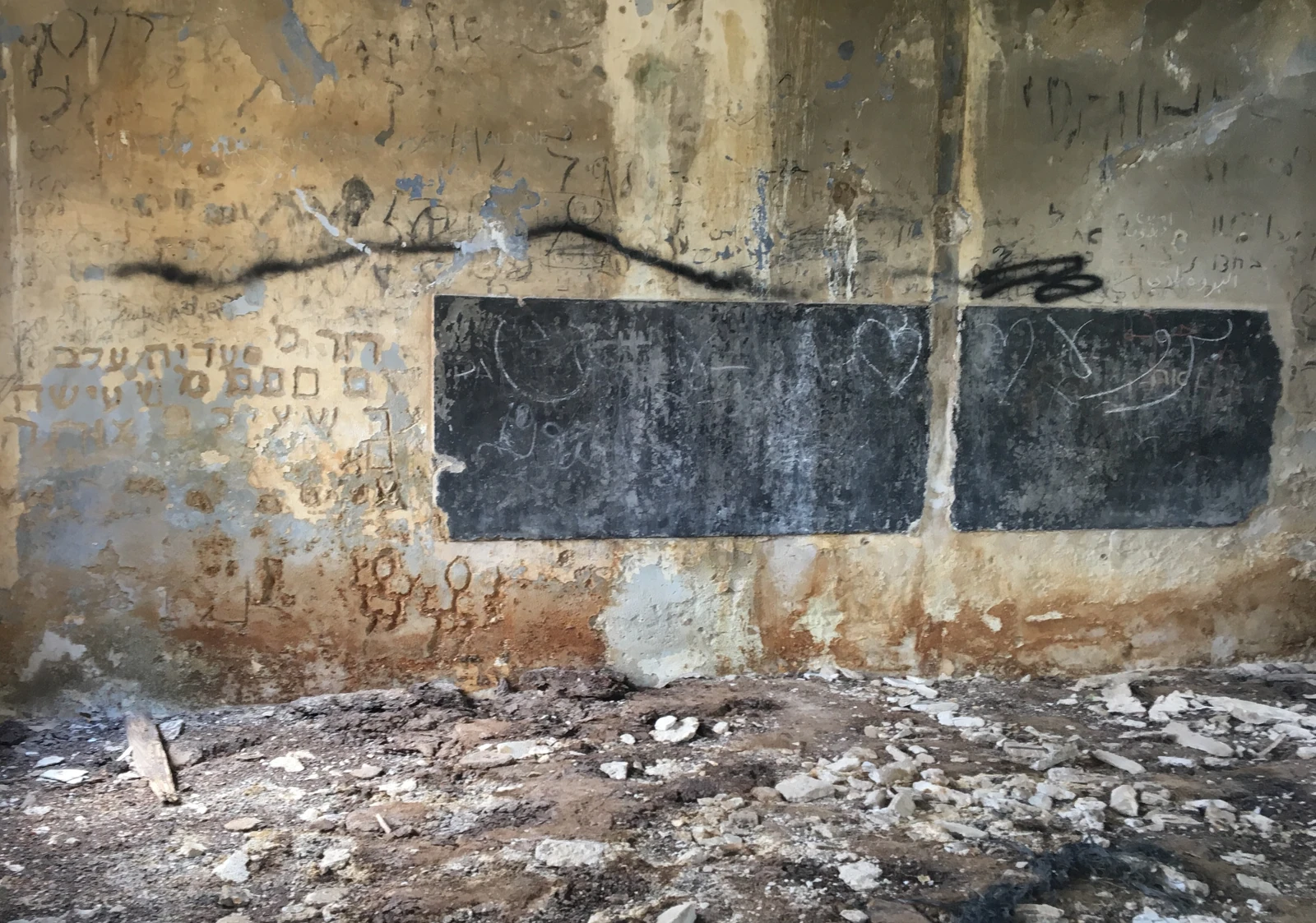
The surviving elementary school
A present-day photograph of the surviving school. It documents condition and material in 2019 only; it does not reconstruct the use or detail of each room before 1948.
Present-day evidence of a surviving building, limited to visible material condition.
CC BY-SA 4.0; credit Wafaa Khatib, link the licence, and note the technical conversion.
Open the image and licence termsDo you hold visual material connected to al-Birwa?
The submission channel is not open yet. Review the ownership, consent, and privacy requirements that must precede any transfer.
Visual lab · three matched viewpoints
If the village had continued
Aerial, street, and wide side view: each route begins with a generated interpretation of roughly 1947–1948, then transforms that exact frame into a conditional 2026 scenario. Camera, horizon, roads, and landmarks remain fixed.
Both sides are generated: historical interpretation and conditional scenario—not evidence
Each route uses one locked camera. Horizon, terrain, roads, and landmarks remain fixed, and the 1947–1948 frame itself is transformed into 2026 so change is visible without viewpoint drift.
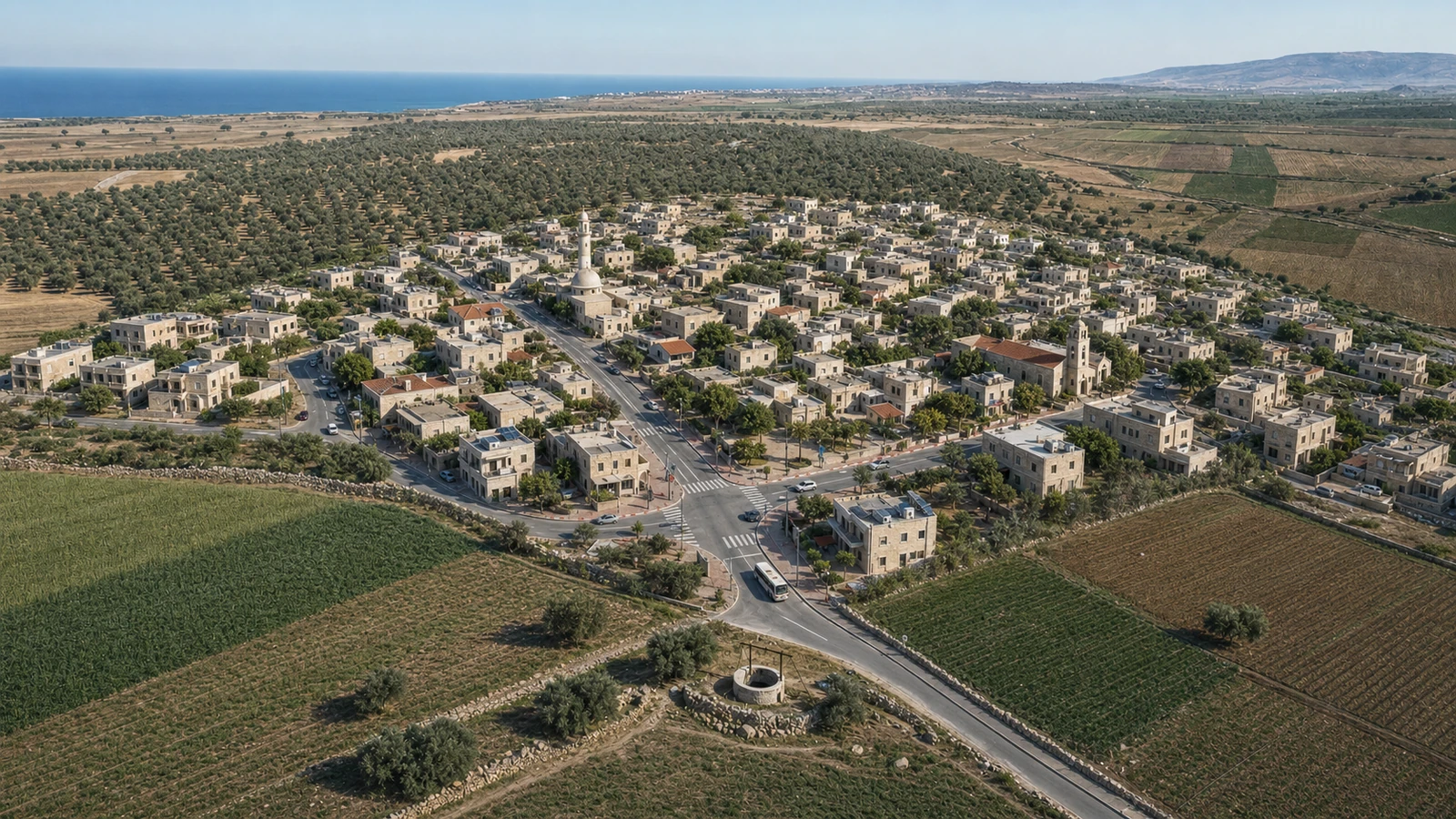 Generated image · conditional 2026 scenario2026
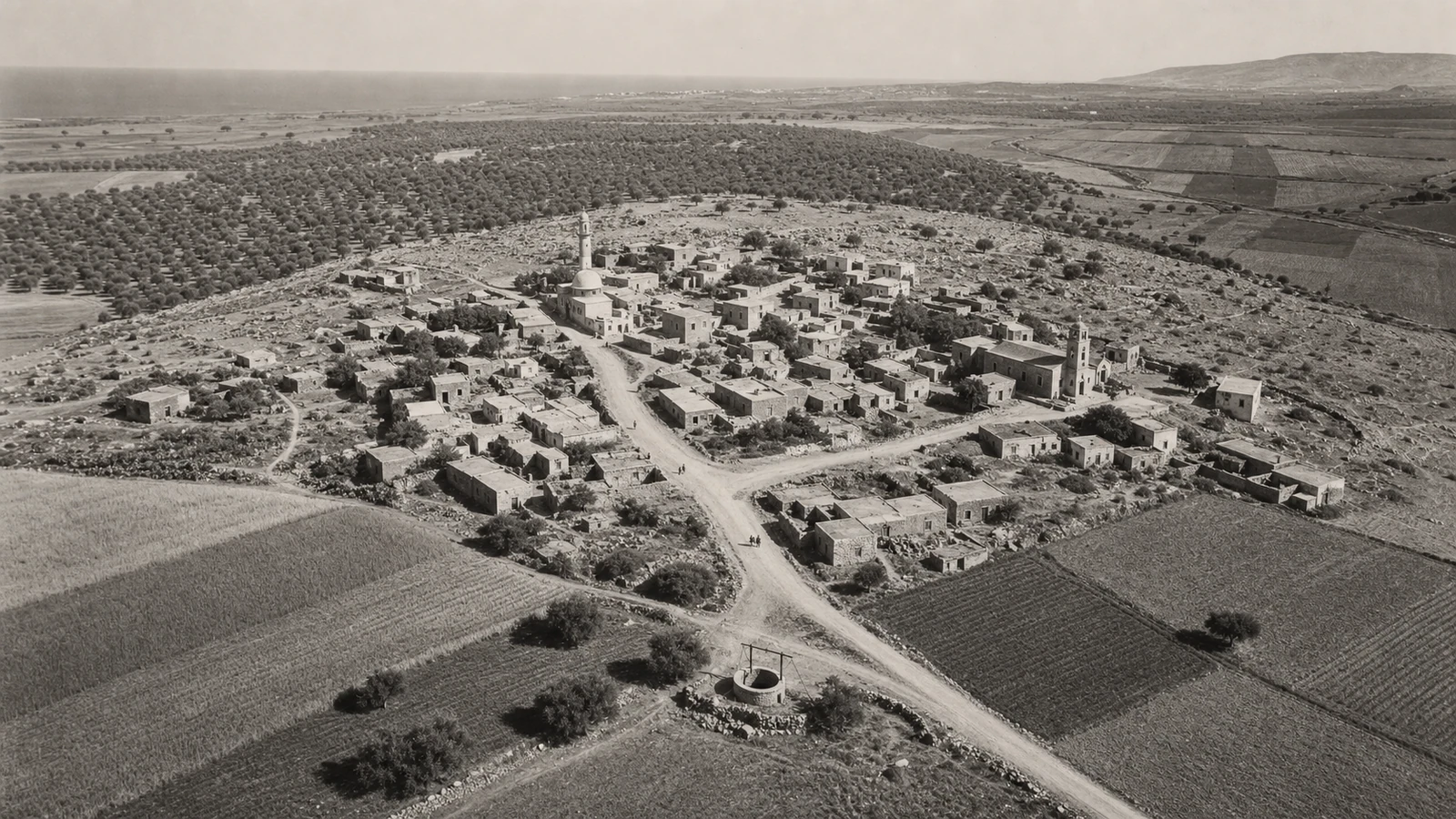 Generated image · 1947–1948 visual interpretationAround 1947–1948
The contrast is deliberate: 1948 is monochrome, rural, and unpaved; 2026 is coloured, inhabited, and serviced, while roads, hill, well, and landmarks remain aligned.
Drag the handle directly to either image edge. Arrow keys, Home, and End also work.
Trust and source panel
Facts, differences among 1948 accounts, present-day context, and conditional imagination remain separate and inspectable layers.
Registered to a source
- 996 people and 224 houses in 1931, and 1,460 people in 1944/45.
- A rocky hill, two intersecting roads, stone-and-mud houses, and changing roof materials.
- A mosque, church, two schools, three presses, and a cereal-and-olive economy.
- Multiple stages of capture, return for harvest, and firm control across June–July 1948.
Unresolved or unavailable
- A precise plan locating every pre-1948 house, facade, and lane.
- A publication-ready pre-1948 aerial photograph with unambiguous identification.
- Fighting details on which the source accounts differ.
- Any 2026 development form as fact or forecast.
al-Birwa — Interactive Encyclopedia of the Palestine Question
History, demography, institutions, agriculture, displacement, and site condition
Institute for Palestine StudiesOpen the original source ↗al-Birwa locality record
Map context, locality position, and population snapshot
Palestine Open MapsOpen the original source ↗Mahmoud Darwish — biography
Documenting birth in al-Birwa
Institute for Palestine StudiesOpen the original source ↗1940s Survey of Palestine map
Historical topographic and road context; it does not prove facades or building heights.
Wikimedia CommonsOpen the original source ↗Overlook toward al-Birwa’s site
Present-day landscape context only; not a pre-Nakba photograph.
Wikimedia CommonsOpen the original source ↗The surviving elementary school
Present-day evidence of a surviving building, limited to visible material condition.
Wikimedia CommonsOpen the original source ↗Record limits
The page contains no building plan, ownership boundary, or verified pre-1948 aerial photograph. Historical interpretations follow descriptions of the hill, roads, houses, institutions, and agriculture without claiming to recover one exact facade or lane.
Review sources